# 9 - Cross Coves
Rated: Moderate to Strenuous
9 - 11 miles, one way
The Cross Coves Blueway kayak trail is located on
west Lake Moultrie between two popular boat ramps. It
consists of miles of beautiful and interesting coves. There
are numerous rookeries of Egrets, Great Blue Herons,
Anhingas, Cormorants and Bald Eagles. You are nearly
guaranteed to see an abundance of wildlife on this paddle.
-This adventure, more than any other on the Berkeley
-Blueways, is a birder's and photographer's paradise.


Difficulty: Moderate to Strenuous, but only due to distance.
Distance: 9 - 11 miles, one-way, from boat ramp to boat ramp. However, may be paddled from either boat ramp and split up in a couple trips (see "IMPORTANT" note below).
Time: 4 - 5.5 hours, minimum.
Crowds: Moderate. You're guaranteed to see boaters/anglers in this area.
IMPORTANT: Doing the entire paddle in one day requires staging two vehicles or arranging pickup. Because of distance, this can be a very long day on the water. This trip is best suited as a slower exploration paddle and completing the adventure in at least two trips. In other words, paddling north from the Fred L. Day Boat Ramp, and then paddling south from Angel’s Landing Marina.
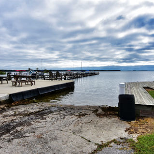
Put In: Fred L. Day Boat Ramp, Boat Landing Way, Cross, SC 29436. GPS: 33.295429, -80.156345 or 33°17’43.5”N, 80°09’22.8”W. PHOTO of BOAT RAMP.
Take Out: Angel’s Landing Marina, 1556 Viper Road, Pineville, SC 29468, 800-315-3087. GPS: 33.381196, -80.091654 or 33°22’52.3”N, 80°05’30.0″W. PHOTO of BOAT RAMP.
Fees/Permits: No fee for Fred L. Day Boat Landing. $5.00 parking fee (as of December 2024)) for Angel’s Landing Marina.
Current: Negligible, generally south direction.
Tidal Influence: None.
Precautions: Winds above 10 MPH can be tough for a paddler on Lake Moultrie. There is a lot of open water for wind to intensify and cause waves/whitecaps. There are hundreds of tree stumps just inches below the water’s surface. These can flip a paddler if a boat gets wedged on top. Tip: these stumps can usually be seen with polarized sunglasses.
Water Level: For this Blueway paddle trail, water level is not as much of a concern unless you go deep into some of the coves. It’s best to have a water level above 74.50. Lake Moultrie Water Levels, click HERE.
So Much History Nearby: Did you know Berkeley County has more than 110 historical markers and historical points of interest? CLICK HERE to find your Adventures in History!
Weather on the Trail: Click HERE


