# 7 - Bicycle the Lake
-Moultrie Passage
-Palmetto Trail
Rated: Strenuous, if biking entire distance
27 miles, one-way
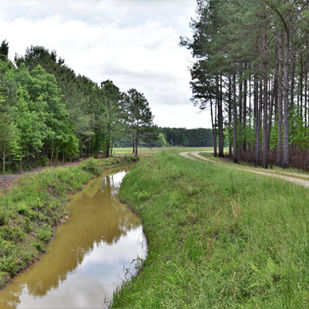
This passage of the Palmetto Trail follows the
scenic and popular Lake Moultrie, one of the
state's largest bodies of water. Lots of variety is
guaranteed to keep things interesting and scenic;
bottomland/swamp habitat, water impoundments,
forest-service roads, hardwood and pine forests,
-and wildlife including herons, egrets, ibis, bald
eagles, fox squirrels and alligators. This is a
fantastic passage for bikepackers because it
offers some of the best sunrises and sunsets
in the South Carolina Low Country.

Palmetto Trail's Information on the Lake Moultrie Passage: Click HERE
Difficulty: Strenuous if biking the entire distance.
Distance: 27 miles, one-way, total passage length.
Time: 5 - 8 hours. Note: the distance may not seem long, however, there is nearly always strong winds
atop the water impoundments of Lake Moultrie, and there is soft sand and gravel to negotiate.
Trail Surface: Sand, pine covered, raised boardwalks, planks, bridges and bottomland/wet sections.
Trail Marker: Yellow and white blazes on trees, and good signage on the trail.
Bike Type: From the northern trailhead to the Top of the Canal, a mountain/trail bike with minimum
of 2.0" knobby tires is recommended.
For the rest of the passage, which is mostly the water impoundments of Lake Moultrie, nearly any
bike type will work; road bikes (with tires over 28c), hybrid, trail/mountain bikes, "gravel" style bikes
and even kids' bikes.
Crowds: Light.
Fees/Permits: None.
Precautions: Biting insects can be formidable in warmer months. Bring insect repellent. Many miles of
this passage traverses the long water impoundments of Lake Moultrie. There is little reprieve from the sun.
A wide brim hat and sunscreen and sunscreen are recommended.
Eadie Lane Trailhead: Eadie Lane, Cross, SC 29436. GPS: 33.381806, -80.134250 or 33°22'54.5"N 80°08'03.3"W.
HWY-52 Trailhead: N. US HWY-52, Bonneau, SC 29431. GPS: 33.278472, -79.962444 or 33°16'42.5"N 79°57'44.8"W.
Contacts: South Carolina Department of Natural Resources, Bonneau, SC Office 843-825-3387.
Santee Cooper 843-761-4068. Palmetto Trail 843-359-8775 or 803-771-0590.
So Much History Nearby: Did you know Berkeley County has more than 110 historical markers and historical points of interest? CLICK HERE to find your Adventures in History!
Weather on the Trail: Click HERE
Try Our Favorite Lake Moultrie Passage Day Bike Routes
Russellville Flats Top of the Canal Ride


